
Full Moon Hike
What's it about?
The hike starts at the main square in Mogersdorf. From there, the route leads along Friedhofsweg (Cemetery Path) towards Pfeiferberg and continues through the forest to the Mogersdorf Fire Station at Berg, where a refreshment station awaits. After a short break, the trail continues via Gmoserweg to Schlösslberg. Along the Friedensweg (Peace Path), the route goes downhill through the forest to Unterer Mitterweg and finally back to the starting point at the main square. The distance of the route is approximately 7.7 km, with a pure walking time of about 2 hours. Equipment: Hiking shoes, headlamp or flashlight. A safety vest or reflectors are recommended.
Where?
Hauptplatz Mogersdorf
Mogersdorf 2
Organiser: Verein zur Förderung des Naturpark Raab
Source: feratel-deskline
Also listed on: burgenland.info
You might also like
Similar events in Burgenland

Mon 26 Oct
Vorankündigung: Wandertag der FF Eltendorf
Eltendorf

Mon 26 Oct
Wulkawanderung
Trausdorf an der Wulka
Mon 26 Oct
Wanderung zum Nationalfeiertag - Naturfreunde Pöttsching
Pöttsching

Mon 26 Oct
Dank- und Friedensgottesdienst zum Nationalfeiertag auf der Burg Neuhaus
Neuhaus am Klausenbach
Mon 26 Oct
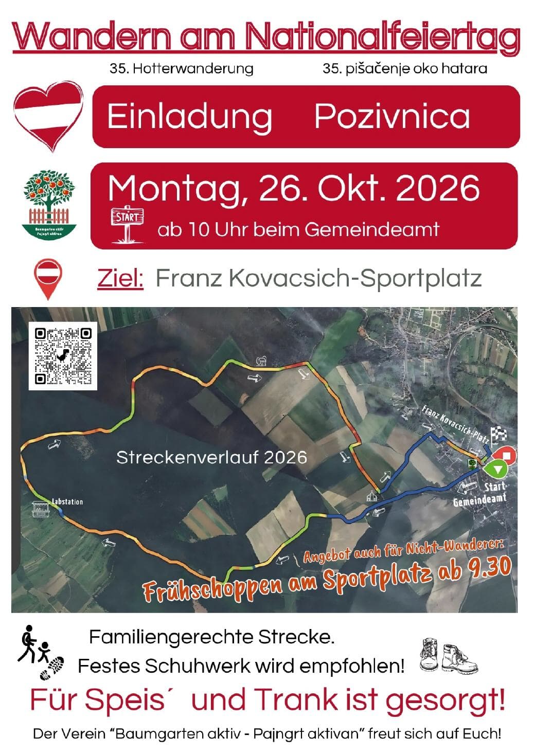
Hotterwanderung mit Frühschoppen
Baumgarten
Mon 26 Oct
Familienfest beim Nationalparkzentrum Illmitz Mo
Pamhagen
Experiences
Tours & activities in Burgenland
Guided tours, tickets and experiences in Burgenland — bookable via GetYourGuide.


Übernachten
Unterkünfte in der Nähe
LandRastHaus Maria Bild
3,6 km entfernt
Bei Booking.com prüfenGasthof Gerlinde Gibiser
4,9 km entfernt
Bei Booking.com prüfenGasthof Rudolf Pummer
4,9 km entfernt
Bei Booking.com prüfenReiterhof Rössler
5,4 km entfernt
Bei Booking.com prüfenAffiliate-Links (Booking.com) — am Preis ändert sich nichts. Unterkunftsdaten: © OpenStreetMap-Mitwirkende (ODbL).