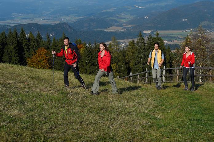
 Photo: Tourismusregion Mittelkärnten
Weitwanderweg Vierbergeweg
St. Veit an der Glan, Carinthia
The Vierbergeweg long-distance hiking trail is signposted and marked in both directions – follow the "Red V" color markings. It is recommended to walk the trail clockwise (St. Veit – Magdalensberg – Ulrichsberg – Veitsberg – Lorenziberg), which corresponds to the traditional route. At the three valley crossings, there are train stops for the return journey. The Vierbergeweg starts at the Fuchspalast in Sankt Veit an der Glan, heading east towards the Taggenbrunn castle ruins, where, after a short ascent, you can already see the Längsee and St. Georgen am Längsee Abbey. From here, it goes steadily downhill to the Längsee, which invites you to rest on its beautiful shores. Passing St. Georgen am Längsee Abbey, the route leads on a forest path through a wooded area and across wide fields to the "s’Hubertusplatzle" wayside shrine with a view of the famous Hochosterwitz Castle. Near Thalsdorf, the path goes under the federal road and railway (Launsdorf train station nearby). Passing Hochosterwitz Castle, the historical highlight of the region, you walk on the easily accessible field path towards St. Sebastian. Here, the access point to the path up the Magdalensberg is located right next to the church. Climbing up the Magdalensberg, you cross beautiful meadows, pass old farmhouses, and repeatedly have magnificent views of the surrounding landscape. A final steep ascent rewards you at the summit with a magnificent panoramic view extending to the Karawanken. From here, you can see the three other mountains of the Vierbergeweg: Ulrichsberg, Veitsberg, and Lorenziberg. Descending from the Magdalensberg, you next reach the village of Ottmanach and Meiselberg Castle (Caution: short section of the path on the main road). After the Prunnerkreuz, the path leads south, towards Maria Saal directly to the famous Roman monument, the "Herzogstuhl". A detour to Maria Saal Cathedral or the Carinthian Open-Air Museum is possible from here. Maria Saal train station is in the immediate vicinity. Continuing on the Vierbergeweg, at the turn-off to the church in Pörtschach am Berg, the well-developed, in sections steep ascent to the Ulrichsberg begins (Caution: on the Ulrichsberg, follow the wooden signposts!). The Ulrichsberg is a popular viewpoint in the Klagenfurt area and is known for its church ruins. After descending from the Ulrichsberg, you reach the wide Glantal via Karnberg and Zweikirchen to St. Leonhard (train connection in Liebenfels, two km away). From St. Leonhard, the sight of the Veitsberg accompanies you on your further path to Kulmbauer, until you reach Liemberg Castle. The foot of the Veitsberg is circled on the valley floor of the high valley until you reach Zwattendorf. After overcoming the steep ascent to the Veitsberg, you can enjoy the best view on the west side of the third mountain through the treetops. A swift descent from the Veitsberg follows on forest and gravel roads and through the forest to Gradenegg, where you can let your gaze wander far over the entire valley and to the Ulrichsberg and Magdalensberg. In Sörg, you have another opportunity to strengthen yourself at the inn or snack bar for the ascent to the Lorenziberg. From here, it finally goes downhill via the forest path and through the impressive Hammergraben back to the old town of Sankt Veit an der Glan.
Opening hours & season
- 01.04.2026 – 31.10.2026daily09:00–19:00
Map & directions
Anzeige
Events nearby
Upcoming events within 10 km.


Experiences
Tours & activities in Kärnten
Guided tours, tickets and experiences in Kärnten — bookable via GetYourGuide.