 Photo: Thermen- & Vulkanland · Daniela Neubauer
Stradner Kogel
St. Anna/Aigen, Styria
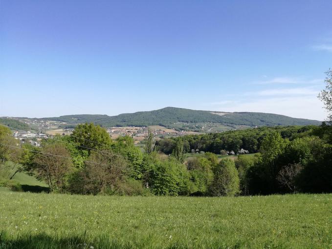
Highest elevation in the Southeast Styrian Hill Country The fertile volcanic soil enables the lush growth of various agricultural crops. The Stradner Kogel is very popular as an excellent hiking and recreation area. Especially the Waltrafelsen and the Höllischgraben attract many visitors. The Stradner Kogel has great strategic importance. Already during the sieges by Turks and Kuruc, signal fires, so-called "Kreidfeuer", were lit on the Kogel so that the surrounding population could be warned in time of new raids and people could get to safety. During the Second World War, the Wehrmacht built an air reporting and air traffic control center under the code name "Gladiole" on the Stradner Kogel; the foundations are still visible. Currently, radio and television use the good location. The widely visible ORF transmission mast and mobile phone facilities are located on the Kogel. The geological history of the Hochstraden volcano In a first explosion 2 million years ago, a huge crater was blown out of the ground. This explosion ejected only a little volcanic ash, but huge masses of lava flowed out and formed a lava lake. This is a typical sheet eruption. Through uplifts and subsidences of the area, erosion and washouts, the current appearance was formed over millions of years. From north to south, the basalt mass of Hochstraden is 8 km long and 2 km wide. The nephelinite sheet reaches a thickness of 80 meters and even more on the summit of the Stradner Kogel. The basalt of Hochstraden is considered one of the hardest in Austria.
Opening hours & season
- 14.01.2026 – 31.12.2026dailyopen all day
Map & directions
Events nearby
Upcoming events within 10 km.

Experiences
Tours & activities in Steiermark
Guided tours, tickets and experiences in Steiermark — bookable via GetYourGuide.