 Photo: Burgenland Tourismus | stillsandemotions
Ruster Hügelland
Rust, Burgenland
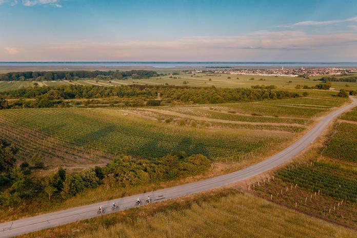
The Ruster Hügelland ("Szarhalmer Wald" in Hungary) is a narrow ridge running parallel to Lake Neusiedl, stretching for about 12 kilometers from Schützen am Gebirge in the north, past Mörbisch am See, into Hungarian territory to Fertörakós (Kroisbach). The highest elevation is the Goldberg south of Schützen am Gebirge at 224 m. A small nature reserve with an area of 1 ha was designated here in 1973. In addition, the Goldberg and its adjacent areas have been part of the Natura 2000 area Neusiedler See-Seewinkel since 2000. Together with the Leithagebirge, the slopes of the Ruster Hügelland are considered the easternmost foothills of the Alps. The core of this ridge consists of crystalline bedrock, encased by Leitha limestone, calcareous sandstone, and loose sediments. The bedrock only reaches the surface in a few places. Here, rugged, irregularly shaped rock fragments in vineyards or on the forest floor reveal the underlying crystalline rock. Despite its comparatively low height, the Ruster Hügelland forms an effective barrier against bad weather fronts from the west. Hailstorms are mostly diverted southeast towards Hungary, while thunderstorms generally follow the Leithagebirge northeast.
Map & directions
Anzeige
Events nearby
Upcoming events within 10 km.

Experiences
Tours & activities in Burgenland
Guided tours, tickets and experiences in Burgenland — bookable via GetYourGuide.