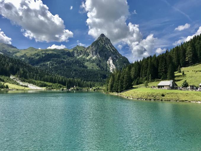
Mountainbikeweg - Rieding Route 04
Zederhaus, Salzburg
The Rieding Route starts in Zederhaus at the church. Follow the federal highway along the toll booth, take the right turn, and continue on the asphalt road. Variant Bartlalm: Before the bridge at km 2.7, turn left — a stretch parallel to the highway on a gravel road — ascend in several switchbacks — crossing a stream — Bartlalm (approx. 7.4 km, 464 meters elevation gain) — through the districts of Hub and Wald until km 7.0. Variant Riedingweg: at km 7.0, turn left along the forest road until km 10.1 — junction with Rieding route — turn right uphill to the Rieding toll station (km 7.9). Variant Muhreralm: shortly before the toll station, turn right and follow the gravel road — through the Neußeswirtalm — over a wooden bridge, then steeply uphill along the gravel road to Muhreralm (approx. 3.0 km) — return on the access road. Continue to Schliereralm, past the lake to Königalm — from here, gravel until Örgenhiasalm/Wendepunkte — return on the access route. Huts along the route: Schwarzenbichlhütte, Schliereralm, Gruberalm, Hoislalm, Ilgalm, Königalm, Zaunerhütte, Örgenhiasalm, Bartlalm, Muhreralm. The Rieding Route is 15.5 km + 7.4 km + 2.4 km + 3.0 km long (each one way). Elevation gain: 617 hm + 464 hm + 233 hm + 219 hm, from 1206 m to 1711 m.
Map & directions
Events nearby
Upcoming events within 10 km.

Experiences
Tours & activities in Salzburg
Guided tours, tickets and experiences in Salzburg — bookable via GetYourGuide.